Moriarty Lake was finally conquered today. After months of trying to find a way into the "Promised Land" and to get to Moriarty Lake, Andy and I made it.
A few days ago , Andy sent me a GE map with a very rough looking trail on it, called simply "the key". Well, today, we tried it. Andy was not optimistic and mentioned several times that he had his doubts, but I'm glad to report, his pessimism was misplaced. We made it! No more gate Nazi; no more logging company dictating our access to public lands.
We set off early after meeting with our mentor, Ryan, at Starbucks. Ryan deserves some credit here, before I go on; he's the man who "infected" me with this dirt bike/dual sport lark, and I seem to have passed the disease onto Andy. After coffee, it was off to Doumont Road and the tank traps. We made quick time on branch 142 north and then the Englishman River Main south until we got to 155N and took a left (east). We had been down this road a month or so ago and were both stopped by snow, but given the recent warm/hot weather, we decided to try it again. Be warned, there were several large trucks (quarry-road surface trucks and logging trucks out and about and they didn't seem to mind if they squashed us...Fascists? Probably not, but I doubt they use sunscreen on their necks).
Here are the maps:

 This trail is very easy to miss. If you reach the dead end, then you've missed it. It's been "quadded" a little, but is fairly easy to traverse. I imagine if it was wet, then it could be tricky with the wood, branches and bark that litter the floor. Once you're on the "Nazi Bipass" trail, then you are home free. But be warned: while this trail starts out easy, it does get fairly rocky in parts and worse, almost obscured by small alder . It's nothing to stop you though, but take your time.
A Movie of Traversing Andy's Key Trail:


But if this trail works, then it leads to a far more traversable trail than Andy's Key does.
While Andy's Key is a viable alternative to a locked gate and gate keeper refusing access, it is a long, slow and technical trail. Within a few years, unless you quadders get in there with chain saws, we're going to be SOL with that trail.
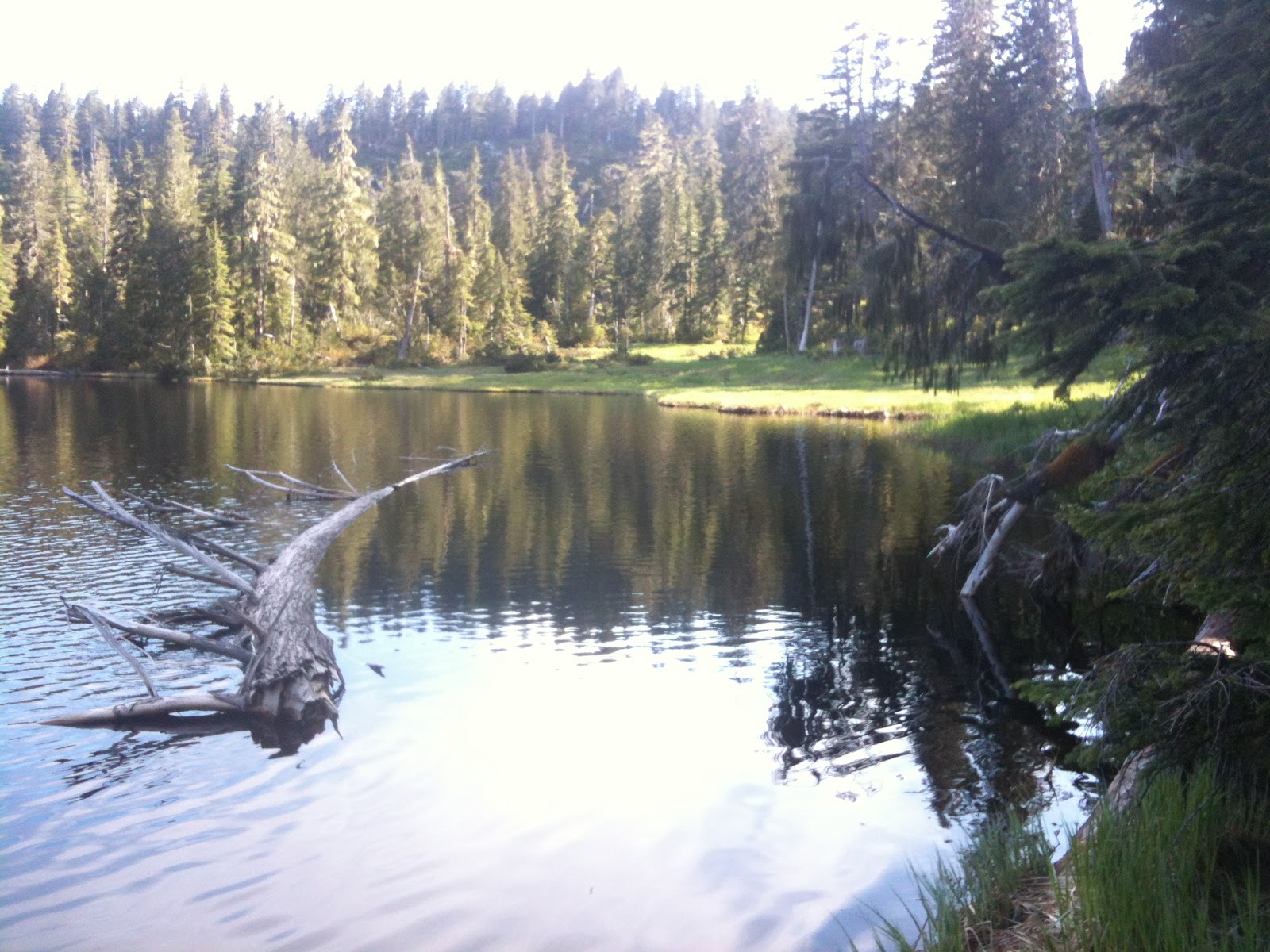
Unfortunately for me, and Andy, we only had time for a brief stop at Moriarty Lake for lunch. The side we stopped at was quite shallow and weedy, and wouldn't be a good fishing spot. However, it looks like a nice place for a camp (perhaps on the little island?). I had to rush back to pick up my daughter from sailing, and it would have been nice to check out the 4th Lake gate en route to the Cowichan Valley which we weren't allowed to pass last week. As it was, we had to speed back via 4th lake and run the gamut of the Gate Nazi. However, all gates were open, and the Nazi and his caravan were elsewhere... A week ago he told us no access for eons; this week no sign of him. Perhaps the Russians got him.
Here are some pictures and vids of the day's events:
 Above: From just before Andy's Key: a view of Arrowsmith.
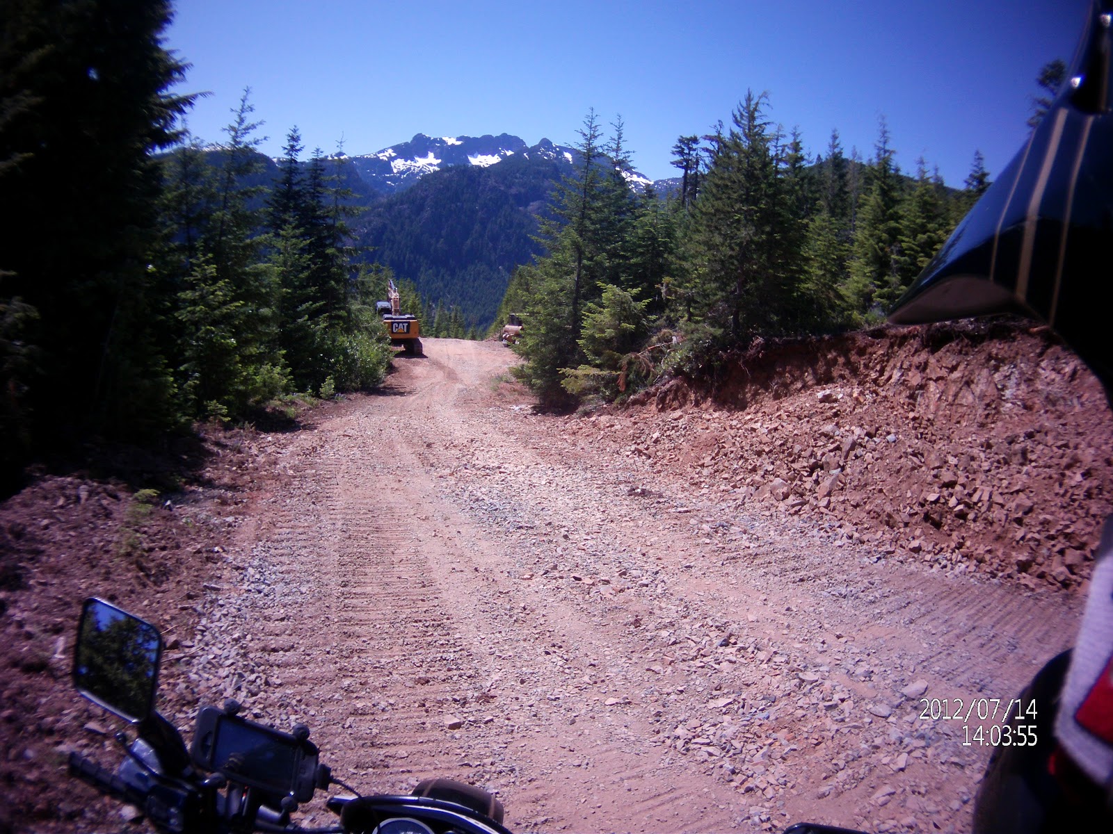
 Above: The entrance to Andy's Key; Below Moriarty Lake and Mountain: finally Moriarty is vanquished...Sherlock Dods...It's got a ring.

 Below: the Moriarty Road is an easy quick road; a far cry from the choked alder trail we had been on some minutes before...

A Pano Vid of the area...
Well, lots to explore! Dirt in my future...
Paul
 |
Map 1 Above: Head NW on 142 from Boomerang until you reach the Englishman River Main. Turn left and head SW until you reach Branch 155N on your left. Take it.
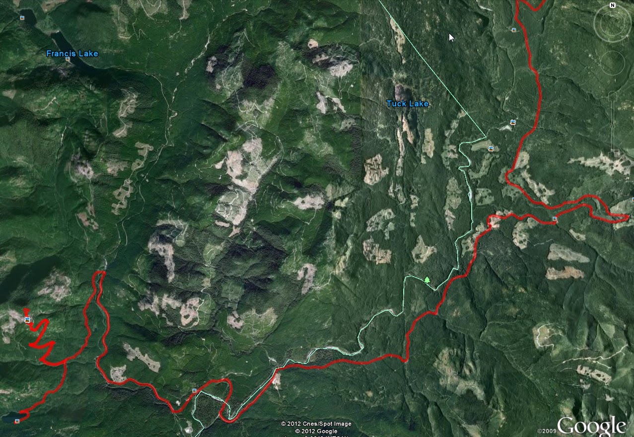
Map 2: Above - an overview of the entire route.
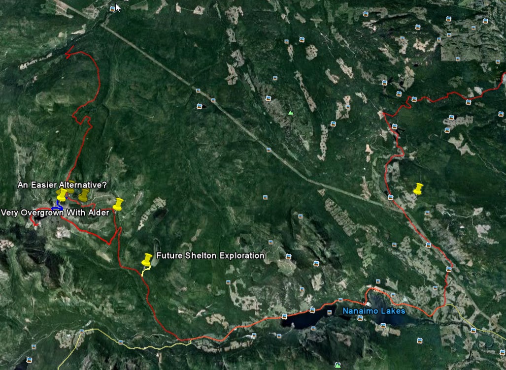
Map 3: Below: Head south on 155N until you reach the pin labelled "An Easier Alternative"
  |
Map 4 Above: more detail of the area;
Map 5 Below: look fro the lime green connector "Andy's Key to Paradise"...This is the trail that connects the NW LD to the Nanaimo Lakes LD...The one they don't want us to know about...

Map 6 Below: A close up of Andy's Key Trail (Lime Green).

A Movie of Traversing Andy's Key Trail:

Map 7 Above: There was another trail on our right which looked in good fettle (in Blue) before we got to Andy's Key. This *may* provide us with an easier route into the Moriary Lake road which is an easier trail than the alder/rocky strewn trail we encountered (see Map 4 above)
Map 8 Below: Detail of the Alternative Key (Paul's Key). The pink trail will be the challenge...:

But if this trail works, then it leads to a far more traversable trail than Andy's Key does.
While Andy's Key is a viable alternative to a locked gate and gate keeper refusing access, it is a long, slow and technical trail. Within a few years, unless you quadders get in there with chain saws, we're going to be SOL with that trail.
Unfortunately for me, and Andy, we only had time for a brief stop at Moriarty Lake for lunch. The side we stopped at was quite shallow and weedy, and wouldn't be a good fishing spot. However, it looks like a nice place for a camp (perhaps on the little island?). I had to rush back to pick up my daughter from sailing, and it would have been nice to check out the 4th Lake gate en route to the Cowichan Valley which we weren't allowed to pass last week. As it was, we had to speed back via 4th lake and run the gamut of the Gate Nazi. However, all gates were open, and the Nazi and his caravan were elsewhere... A week ago he told us no access for eons; this week no sign of him. Perhaps the Russians got him.
Here are some pictures and vids of the day's events:


A Pano Vid of the area...
Well, lots to explore! Dirt in my future...
Paul