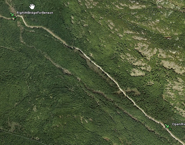
I had a Monday to kill today: Labour Day. It's the last day of freedom for teachers all over the northern hemisphere until next year, so I decided to use it. After reading about Andy's aborted attempt to follow this route on his blog I decided to try it from the other end.
Andy's route includes a picturesque stretch behind Mt. Benson.
So I started at the north end and proceeded generally south. Starting at Doumont, I turned left and rode past two 4 by 4's and a couple of slow dirt bikers (wow - never seen that before!) and to the Boomerang junction, where I turned south (left).
This road is well used and the grading is great. I took a couple of shots from the photo symbol area in the image above...
It's a beautiful lake and the boat launch is a nice touch. There was some shooting from the other side, so I moved on...rapidly!
Then I bore left. (avoiding the Cottle Lake turn off to second lake via the outback...beautiful views, no traffic there...but that's for another blog)...
A while ago, Andy, Ryan and yours truly were taken on a hell ride to a lake by Ryan. We had to stop as the trails got so small, even Andy's TTR125 was having trouble getting the bars between trees...Well if you take the left above, you will end up on the other side of that lake. So don't. Do as it says: keep going...
The road is great and 50kmh is easy to maintain while sitting if need be...
When you get to the bridge, keep right...(when heading south)...And that's a river that can see winding away in the valley below on the image. You never get to see it, but if you stop just prior to the bridge, there is a steep drop off with some cribbing. The sound of a waterfall echoes up loudly.
This is where the fabulous views of the backside of Benson are revealed...on the Open Ridge...
As you can see, the road surface is great, as are the views to the north...
Looks so near, yet so...
Carrying on the trail, there were two mystery quad trails the first one to the right and the second to the left. They look totally do-able, at least the first portions of them. I believe the first one goes to Lucid Lake, which you can see on the left of the picture...Could be a good place for a spot of fishing...Must give that a try!
There is a junction: don't take the right turn...The road branches into skidder trails with large boulder crush and they're quite steep...It doesn't seem to go anywhere...
The fabulous view points along the road are just that and, if I had a good camera, rather than a phone, I could take better pictures! These don't do it justice...
The road is still great...
When you get to the junction, if you take the left fork, then you will end up at a locked gate. I will show the above picture in more detail, as the gate poses a problem as Andy indicated. You'd need two people to lean or cant the bikes and support them in order to get them under the low gate...Here's a more detailed map of the Gate, and the Gate Bipass...
If you take the right fork at the junction and proceed a short way up hill, you will find a quad trail. Walk it first. Follow the arrows. I the dry this is a cinch. In the wet, with gumbo mud, it would be suicidal. It's littered with roots, ditches and boulders...It joins a great logging road which spits you out just below the gate...
Above: this is what the entrance looks like.
The dust would turn to pretty slick mud...
Wind around over roots and rocks and follow the arrows...
...More arrows
...And you join the road...Which leads you here...
Here you can see SuziQ glowing with victorious pride...
At the junction of Nanaimo Lakes Road and South Forks Road...Take the left for Nanaimo...
All in all, the trip was about 30 clicks give or so, and well worth doing again. Finally, I'd like to thank the young first-nations couple who generously, while toking up and undressing (them not me), offered me the information that got me round the gate. I left them quickly to continue with their carnal delights behind the gate and, in a ditch! Romantic.
Paul


