Well there you have it. Easy. Made this one in five minutes. Use a straight edged blade - it's easier to press the indentations into the can top (the jets). The thing really works and boils 3 large cups worth of water in just over 6 minutes. Very effective, and uses hardly any fuel - you're talking two tablespoons. I used some fondu fuel ($2.99 for 500ml at the local hardware outlet). Cheap, cheerful and, above all, light.
Tuesday, November 26, 2013
Wednesday, November 20, 2013
Dual Sport Camping Weight Loss Part One: Make A Beer Can Alcohol Stove
As a dual sporter, you always worry about weight. I spent the first month of my dual sport bike ownership shedding pounds from the bike. I removed "unnecessary fittings" like passenger footpegs, steel grab-handles, the metal gas tank and fairing, the steel handlebars. Others go further. They buy light seats, lighter rims (unsprung weight is the best to trim they say), shed the stock exhaust and replace it with a 8lb lighter header and can...
Having a DR650 allowed me to carry a ton of stuff, but at a penalty. Still, being a DR, it was heavy anyway, so the weight premium of carrying spare clothing, camping supplies, fishing gear, cooking stoves, fuel canisters, utensils etc. wasn't so critical. As long as I didn't stop on single-track incline, or have to get off and manhandle it out of a quagmire, I was fine...
We all dream about owning that perfect dual-sport bike. You know the one? It's got that KTM suspension, performance, and light frame, but it's got the Japanese bulletproof engine with loooong service intervals and a reputation born of many pan-South American trips. It's got an all-bonded aluminum subframe (not the plastic found on the rear of some of the up market Euro-bikes for weight savings) that you can strap the kit too. Being light it's flickable, malleable and responsive. For looks, weight and performance is a KTM 690, for reliability, economy and ease of maintenance it's a DR650, for road comfort it's a BMW 800...all rolled into one. Or perhaps its the new Canadian bound 280lb CCMGP450 Adventure?
At any rate, so now we've got the perfect bike, what do we do? We proceed to sling every camping gadget and gizmo known to man BACK on it, weighing it down, and transforming it's thoroughbred svelt soul into a turgid, top-heavy tractor...Might as well have bought a KLR...or a GS1200...
I'm guilty of it. Last year I went camping numerous times on the DR I had worked hard at lightening and upgrading. I packed it right up, and was guilty of returning with most of the supplies and gadgets that I packed unused; in fact, we cached a lot of food out in the bush, rather than ride back with it, and I can't remember using my gas stove at all, let alone needed the spare gas canisters...
So next time, regardless of which svelte mount I procure for my future off road adventures, I'll be doing things differently. I'll be focusing less on the bike and more on what I'm packing. It's cheaper that way, and makes more sense.
One of the great weight-loss ideas I've come across (thanks, Andy) is the beer-can stove. It's a great device: it's "a win-win" in every sense. Incredibly light, incredibly cheap, incredibly easy to make, incredibly replaceable, and incredibly effective. In fact the only downside I can find, is that you MUST drink the beer first. Bummer. There are many designs out there, but my beer-can stove has to be made from one can, using only one tool - a knife, and the process has to be easy enough that after a challenging or potentially gruelling DS ride I can drink the beer BEFORE make the stove! As I said, WIN WIN.
Watch the video and marvel.
How To Turn A Beer Can Into The Only Camping Stove You'll Ever Need from Tom Allen on Vimeo.
Isn't it great! As I said, there are others out there, but most of them are more elaborate, requiring more tools, more cans and cannot be made in 3 minutes...
Next week, a (used) tea bag that transforms into a down-filled sleeping bag! Ok, perhaps that's a little far fetched...
Saturday, November 16, 2013
Mt Prevost + Big Sicker Mtn
Took a trip today - my first dirt road since July... With the DR 650, Siouxie, moving on to pastures greener (still at Mile Zero for $3999 - I have some spares for free if you buy her...contact me...), Iris, Isobel and myself had to make do with a Mazda 3 "ride" up to Mount Prevost and then Big Sicker (I hand my head in shame).
We were in search of the old mining site(s) with the idea of taking in some views. Briefly, the road up is amazingly smooth, rock free, and no bike is needed...unless you want to pass the 2 locked gates to Sicker Mine proper that is... Then a bike would work wonders. And I missed mine today. I imagine the roads will get fairly sloppy when the rains come, but today, it was gorgeous. Certainly Mr. Manta (my VStrom) would make it up with no issues at all. Still, that little dirt bike is in the works...there were soooo many little roads to explore up there. Can't wait...Pics:
| Couldn't resist: the Misty McMountain Hop...What can I say? It was just good to be out again... |
![]() |
| Typical Scotts: have to conquer everything... |
![]() |
| Yoga has the "Downward Dog". We call this the "Dirty Doggies". |
![]() |
| Iris on the way up... |
![]() |
| Looking down at the Cowichan Valley from Burgoyne Bay, Saltspring Isl (left) to Cowichan Lake far right. |
![]() |
| Wouldn't you know it, my decent camera was outta batteries...So apologies for the iPhone snaps. That's Crofton Mill, Maple Bay and Saltspring in the far distance. |
![]() |
| The Shebang...Cow Bay in the distance...Great Racing there last summer with the Martin242 Nationals... The Maps... |
![]() |
| An overview of the Prevost to Big Sicker route today - click to enlarge...Get past closed gate#1 and you'll find the ghost town... |
Some more Pano's below...
![]() |
| She's here, she there, she's every 'kin' where...Can't take a damn picture without her poking her beak in...Typical female...(I'm going to pay for that...) |
![]() |
| This is the picture I wanted.. |
Definitely worth the "ride". I will return with Andy on bikes and do the mine proper...
Thursday, September 19, 2013
Siouxsie Departs
It's been an unusually long time since I've posted, but fear not, it's not because I've lost interest in dual sport in general, off-roading in particular or road riding. On the contrary, while a few things have changed - including Siouxsie's departure to pastures greener (Mile Zero Suzuki), I am very much looking forward to getting back into my off-road adventures. If you read my last post, you are aware of my minor prang a couple of months back. The ever robust DR was undamaged; however, my knee took 8 weeks of physio to recover (as did Andy's KLX which I rode into). I decided, as I couldn't ride to sell both my bikes and get a couple of different ones. The road bike I have procured, and am thoroughly pleased with (a 2013 Vstrom). I am now looking for a 250-400cc 4-stroke light dirt bike which is road legal. Cheap is the watch word. While I don't mind older, I do want reliable, light and durable. I intend to continue where I left off, but to tackle some even small trails.
Siouxsie was an excellent bike - even before the mods. The DR's torque and manners were a lot of fun, but she was cumbersome at walking speed going up boulder strewn creek beds etc. Of course, the DR650 was never designed for that, but the bike did it nevertheless. Finally, the bike was incredibly robust and, with the big tank and upgraded front suspension it was a real trail gobbler, able to soak up all sorts of punishment at ridiculous speeds.
So this winter, keep your eye out for something with two wheels that might fit the bill. Drop me a line, and I might just be out there come spring, blogging more and keeping you up to date with what's going on out there...in the back country.
Cheers Paul
Saturday, July 6, 2013
De Cosmos, De Crash, and De Lesson
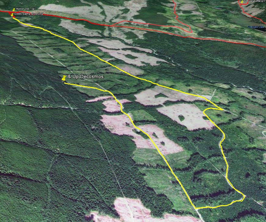
After scouting a route up to Mount Decosmos a few weeks ago, I managed to winkle the hermit out of his lair and entice him to give it a go with me. I actual fact, Andy's bike looked much dirtier than mine as he has only had the time to ride small jaunts lately; whereas, mine, which hadn't been out for two or three weeks, was embarrassingly shiny. But it's summer now, and with a few weeks holidays, it's time to explore. We took the usual route via Boomerang and Cottle to the hydro-lines trail (which is still locked and gated about halfway between Blackjack and Rhodo). Then we turned down towards the headwaters of Nanaimo River and came to the creek crossing. We didn't bother clearing the creek out, although that would have been a better option, and just chugged across it. I say chugged, really we splashed, thrashed and bashed our way across. It wasn't too difficult and within a few seconds we were on the other side and staring down the "four lane highway". And that's just what it is - smooth, well groomed and easy riding - amazing. Whilst traversing the road which was desolate except for a few heaps of bear scat, I started wondering how this road could be in such good nick for an isolated road? Pretty soon, and after passing a few interesting looking left turns towards Blackjack ridge, we passed a derelict hauling truck parked in what must have been the quarry for the road surface.
No more than 100m past the truck is a bridge with a sharp right turn. Take it and climb to the next four lane highway. Turn right (turning left brings you to a locked gate and first lake). Pretty soon you come to some "Cutting Permit" signs. Take the left fork and climb. The switchbacks you will encounter are not bad at all, except for one steep rock strewn one. We picked our way through this fairly quickly though - it's bark is worse than it's bite. Soon you get to some great vistas:
![]() |
| Looking north-west OK mountain and the hydrolines running towards rhodo lake. At this point you can see lots of the routes we regularly ride. |
![]() |
| (Above)Looking north east back to Cottle, Boomerang and Blackjack Ridge you can see many of the trails we use. |
Deciding that the smell of burning alder leaves on our engines, saplings playing with clutch and brake leavers, and the constant whack of branches in the kisser were too much, we turned around to explore a few other more open looking trails. And they were peachy, so peachy, that yours-truly (not leading for the first time this ride) was too busy looking at the vistas and ran smack into the back of a stationary Andy... What a clot! It was completely my fault. Man that's embarrassing to admit, but I'd better get it out there as a sage lesson to myself and any other idiot out there that doesn't look where they are going religiously! Luckily we weren't doing maniac speeds and got off with a few bent indicators, levers and a nasty knee in my case. Thank god for armour (wear it, folks - it's the first time I've needed it and boy did it work, all except one knee guard which took the first impact but not the next, and I now find myself writing this with an icepack on a large swollen knee, but, fingers crossed, no break - I hope...). Poor old Andy's KLX took a knock - as did he - and some spare parts should get the bike legal again very soon...It could have been much worse: but for the sensible clothing we were wearing we could still be up there being nibbled by bears and bearing blow fly larvae...Nice thought. Still, we got back down no trouble and skedaddled via first lake home.
Still, it was a great ride, and am determined to ride it again and walk to the peak next time - making sure we start earlier and I watch where I'm going!
Here are the maps:
![]() |
| Above - a northerly overview of the route; Below a southerly perspective. |
![]() |
| Above and below: a couple of peak shots showing the extent of our penetration into the alder and...embarrassingly the location of my blunder up Andy's chuff... |
Thursday, June 20, 2013
B25 Update#2: Update Me and I'll Update You...
Since my last post on the B25 wreck back in January a few kind souls have come out of the woodwork to offer some more information on the potential location of the Mitchell's final resting place. Firstly I was sent archive photos of the wreck site on Mt. Whymper back in early February, and, yesterday, I had contact (via the blog) with a second individual who has got very close to the wreck site and offers a slightly different location than the old coordinates suggest. It's all very intriguing. But first the photographs (click to enlarge)...
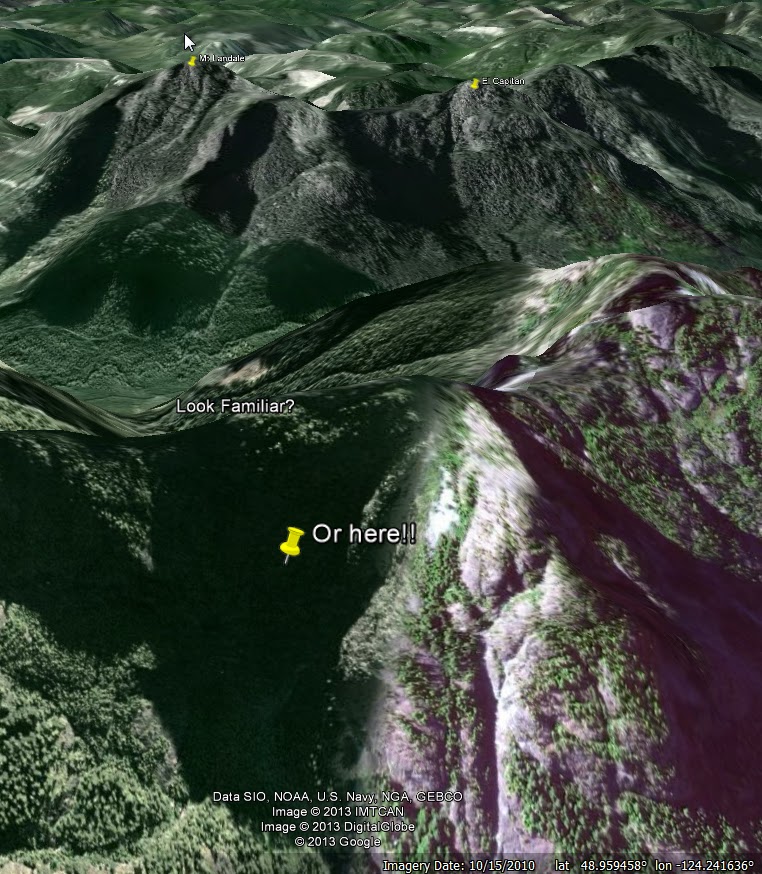
By scouring Mt. Whymper with Google Earth, it is possible to find several locations which may, or may not be (!), the likely location for the wreck. But one intriguing match is nearer the peak itself...
Other pictures from Michael, all of which suggest some sort of elevated valley with a shear terminus - and again, those strong almost vertical contours suggesting falls and snow-melt canyons...:
Today, I got the following updates from a reader, Lindsay Elms, which is very helpful and offer a potential insight into a more exact location based on the fated rescue mission by the blimp:
The crash site is at the 840m level NE of where you have the arrow...I went to the Blimp crash site a week ago which is a couple of hundred metres
from the bomber. AT the time we didn't have the exact details of the bomber (and
couldn't see it). I hope to go in soon (we have special permission from the
timber co to go in via Jump Lake.)Both the Blimp and Bomber sites are historical
war graves even though there were no dead at the blimp crash.
Lindsay Elms
www.beyondnootka.com
Lindsay Elms
www.beyondnootka.com
If Lindsay is right, then there are a couple of likely sites...Click to enlarge:
Well, there you have it folks. If you are reading this and you have more info that I can use to update this so the Lindsay's, Michaels and the rest of us can find this crash site, then please share it. Lindsay, Michael keep in touch and (here's where I grovel), I know two guys who'd love the chance to tag along via the Jump Lake watershed area if given half a chance...No pressure ;)
Sunday, June 16, 2013
Andy's Vicarious Ride
Well, as some of you know, The Real Motorcycle Diaries have dried up for the past six months or so. Andy is very busy right now, so I decided to have a ride for him, visit some of his old haunts and then to post them. I know, generous, but what can I say: that's the sort of guy I am...
Initially, I was going to fish for Andy, catch some trout and eat them for him, but, alas I ran into a snag halfway there.

So it was necessary to turn around and scrap that plan. Poor old, Andy, no fish! (Yes there is THE other way, but, well it was getting late...) What do do? Well creativity is my middle name (or is it torture? - I can't remember, which is another thing I love about getting older), so I decided to go to some of Andy's favourite haunts and remind him of some plans we have, some of the views he is missing, and just generally rub his nose in it tempt him out again next weekend on a real ride.
Then I remembered one of Andy's goals: summiting Mount Decosmos. He has a picture of a potential creek crossing route. So why not find that and check it out? Backtracking along the Hydro trail I found the clearly defined single track trail heading south. It led to this.
The creek crossing doesn't look too bad, but, being as I was alone, it was late, I didn't cross. Two people for help, and it's a snitch. So it was back to the hydro-line trail and off to one of Andy's favourite (and if truth be known -coveted) spur view point trails. It's quiet little number off the Blackjack trail.
So there you have it. Andy caught no fish, didn't get to DeCosmos, and didn't get my rear tyre sand fans in his face. Well you can't have it all, folks. Especially if you're stuck at home. Hopefully see you soon, hermit boy :-)
Subscribe to:
Posts (Atom)