Well today Ryan and I tried to get from Dumount Road to Youbou, or Cowichan Lake. Dumount to Nanaimo Lakes road was straightforward down past Boomerang, left at Cottle, past Blackjack right to cross the power lines and out to Nanaimo Lakes road just east of 1st lake. So far so good.
Just before turning left after 2nd lake and crossing a river
Then we followed 2nd lake's north shore and peeled left at a bridge to follow the Nanaimo River on it's south side. Finally the road turned south onto what the backroad map book calls Branch K. Branch K leads south past Butler Peak on your left (east) and past Mewhorst Lake (McWilliams or Gillespie depending on your map source!) on your right (west). It's then, according to my GPS Topomaps and the Backroad Mapbook, supposed to turn south west (right) into East Shore Main or Cottonwood Main if you go left (south east). Both still head roughly south, but East Shaw comes out further west on Cowichan Lake, while Cottonwood comes out at Youbou.
Well that was the plan. We proceeded down Branch K for about ten km. The road was great at first, but got smaller and smaller. Ryan pulled over, having his doubts that this was a main. We plugged on until finally we got to this...
In the distance: the bridge deck has been chopped by the logging companies. This seems to be the boundary between Timberlands and TimberWest...And they don't want you to cross...
There is a sneak around for quads, but it looked like it would be hard work. The road on the other side looked excellent...better than what we had been on. We even saw truck with a canoe on top pass us in the opposite direction earlier. How did they get around? So we decided to back track to where we had seen a fairly significant looking logging road branch off to the left. We'd give that a try. Perhaps that was the way round?
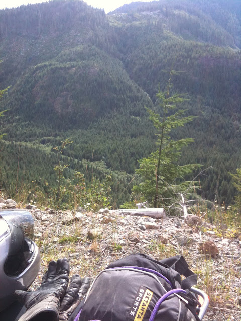
The view was nice...but the road got steeper...and started to disintegrate into a skidder track...These pics make it look great, and it was here...but later on it was a different story...
Luckily for me, Ryan didn't have his camera out, as I slowed down too much on a steep bouldery grade and gracelessly fell over. Bike and rider were ok, but it was a reminder that going out alone and tackling "roads" like this particular skidder track is not a good idea.
So again we backtracked, but not all the way back. We found another left of the first left detour...and tried it. I decided to have a swig of my water, while Ryan was going to reconnoiter it. If he didn't return, then I'd know it was a good bet and I'd chase him up. After 7 minutes and no Ryan, I decided it was a good bet and went up. And up. And up. And up. Bear poo. Ryan? No. Had I missed him. Was this the right road? Had he turned off another spur? Had there been another spur. And up. Getting tricky now. Surely he can't be any further up here, the surface has gone skidder again....Bingo. There he is.
We continued on. Finally, after a lot of exploration we came to a fork which had a rock spray painted with blue writing: "HELL ->"
You know what we did don't you? Yep, we followed it. And, well, yep, it was Hell. Washouts, bizarre bike snapping holes in the road, more washouts, land slides and finally it petered out into an alder choked goat path.
After passing the landslide, we decided this wasn't the route to Youbou!
We backtracked back down the mountain, slowly in my case, and fairly uneventfully, and decided, given the late hour, to head back to my house for salmon, beer, gin and crumble.
Yes we were skunked, but it does mean we have to try again! And that's good, right?
Looking at Google Earth, I just can't see another logical path that seems to stand out. Of course, I've heard from too many folks that they often travel from Nanaimo to Youbou via logging roads, so there must be a way... More research I guess.
Personally, I'm thinking that bridge-out-sneak-around is the way to go...Whatddya think, Ryan? :-)
Here's a map of a small portion of the journey from Google Earth with a few waypoints on it...
Paul.


These shots are great. I'm loving that terrain. I'm surprised you guys haven't seen a bear out there yet. I think I might have a can of pepper spray mounted on my bike!
ReplyDeletehttp://www.youtube.com/watch?v=mLsOcbizFe8&feature=related
No grizzlies out here at least! ;)
Paul, how did you get the route map? Is that an iphone gps finding the waypoints, google maps applying them and a screen snagging program making the image? I want to try this too so I can record all of my trips out.
ReplyDeleteCan you save them within Google Maps and display them as multiple layers?
Hi
ReplyDeleteThree of us went the other way off the Nitinat Mainline a few months ago. The road was in great shape and no difficulty. I am out of town other wise I would send you the track. I am sure someone else will chime in though.
Cheers
Randy
Yup just head west out Nanaimo lakes road, west past 4th lake, down the big hill to Cowichan Main at the t intersection. South takes you to the west end of lake Cowichan. There was a gate near the lake but it was open. There is a portion of the ride that is paved, like a long lost super moto track!
ReplyDeleteAlso From the Nanaimo lakes road / Cowichan main intersection you can go north to port Alberni. This would make a great back way from Duncan to Port Alberni.
Enjoy!