Wednesday, December 19, 2012

1944: A B25 Mitchell Crashes into Mt. Whymper...


I have been looking for more crash sites to record and to visit. I have visited several now, including the Flora Lake B24 Liberator wreck, the Canso wreck in Tofino, and, my favourite - perhaps because it was my first and therefore my most moving - the Mt. Bolduc crash of a Lockeed Ventura.

However, recently I stumbled upon records of another wreck that is fairly close, although likely quite remote. It's a B25 Mitchell, HD345, from 5 OTU, that took off from Boundary Bay on a navigation exercise on May 29th, 1944. It was reported missing later that day.  It was "found" to have flown into the side of a mountain and exploded, although the record confusingly states the plane was struck off the register on 26th July, 1944 having not been found by this date.  The bodies of the five crew are said to be "buried at the crash scene on a mountainside in the vicinity of Mount Whymper."

The crash coordinates were taken from a SAR map years ago, before GPS, were 48 56' N and 124 11' W. I dislike degrees and minutes and so went hunting for verification.

The information from the crash card is the following:

Info from the crash card:
29  May 44
A/C Capt - P/O FJ Whitlock
RCAF 5 OTU
Boundary Bay
Mitchell 345
Navigation Exercise
Fatalities 5
P/O Whitlock
P/O DFJ Schell
Sgt MH Mason
Sgt CA Johnson
Sgt BWMcGregor
Visible from ground - wreckage over an area approximately 1/8 mile long by 100 yards wide at a slope of 45 degrees
Remarks: A/C struck side of mountain, exploded and burned in vicinity of Mount Whymper - remains of crew buried near scene of crash.
Crash Position - orginally 49.00N 124.15W scratched out and replaced by 4858.5N 12411.5 W.

Looking at the coordinates on GE, and realising that 48 degrees, 58.5 minutes is the more likley northern coordinate twinned with 124 degrees 11.5 minutes W, puts you in an area just south of Mt. Whymper near Sherk Lake, north of Youbou.  I'm not sure I believe these coordinates, as it's too low and not nearly "slopy" enough to fit the description of the crash site.


I'm trying a few other permutations of the coordinates...but I'm guessing because of the

lack of coordinate fixes back then, they really do mean Mount Whymper... 

Anyway, the plan is to take a ride out there next summer and look.  In the meantime, I'm

going to dig for any more infor I can find...

Saturday, November 24, 2012

Sundew Work-Around

I had every intention of going fishing at Rhododendron Lake today, but had a change of plan after heading half the way there and meeting ice and heavy frost at about 2000 feet.  So I decided to check out Kidney and then on to the Sundew Main with the intention of seeing if the gate was passable.
 
The ride was great, and there quite a few bikes and quads out; in fact, it was busier than I remember it all summer -almost as if it was a last fling for many people given that the weather was great and the Grey Cup is on tomorrow.
 
The story is via photo and vid...

Above you can see my attempt to cross from Sundew Main onto Seablush Drive, but the gate is absolutely unpassable.  So it's east on the hydro line trail to find a way out...  The Logging Co have done their best at the Sundew Gate, and it's working.  Not even a quad has tried - once - in months.  And no wonder...

...Even if you could traverse the traps, they've got rocks and cement barriers installed to make sure that nothing can pass. 

Either of the two forks on the left as you run east along the easy power line trail will work: Wild Rose Blvd and Seablush have connectors suitable for bikes to the road.  No quads though: you boys will be stuck - the passes are too narrow.

I explored further along the hydro trail and hit two very steep hills after riding through a creek which was a neat experience.  The D606 surprised the heck out of me by getting me up both of the rocky-boulder strewn and quad-chewed single-track paths easily.  "Thank God I don't have to come down them!" was my thought at the time.  That turned out to be premature.  Because after exploring a trail that went north into some woods and ran behind some properties, I re-emerged on the hydro trail and continued East.  However, as you can see, my trail stops at the edge of the photo.  An adjacent land owner had seen fit to extend his property by fencing right across the hydro lines so his horses can "wander"...  If desperate, you could get through, but not without vandalism, and two wrongs don't make a right, so I turned around knowing that those steep hills beconed...

This is what the Wild Rose Blvd entrance to the hydro lines looks like.  My camera is centred on the route.  Just continue towards the maple; keep it to the left if going towards the hydro trail, traverse a short walking trail and - voila - you're there.  Note the sign.  Walking, bicycling and horse riding only - By order of Timberlands.


This is an old car wreck in the woodsy section of the trail above to the north of the hydro-lines.  It was surrounded by a couple of racing bicycles that had been stripped of their parts...Mmmm: stolen goods?  Properties back onto this trail from the north, but there is no obvious way out to the road, and I didn't fancy meeting a toothless local with a bevvy of dead squirrels and a shotgun.  The track peters out, and so you have to double back, take a left, ride up some gnarly grades with roots (a walking trail really) and, thankfully - because at this point I had no idea where I was going! - back to the hydro lines.


This is the section of the hydro lines where you cannot get through because a local 'billy has decided he's claiming, complete with horses roaming around inside... So it's turn around. Pity, because I could see black top half a click on...

While the wide angle camera makes this look relatively flat, it is just about as steep as it's possible to get a bike down.  It is extremely steep and I don't recommend doing this (again - in my case).  There's really no need to, as the trail behind doesn't lead anywhere except to the hillbilly's land claim...

Here are some shots and vids from the rest of the ride:
 Above: Kidney Lake
 A kind gent has left a fuschia picnic chair to fish from.  He used worms...
Kidney looking serene, but lifeless.  Nary a rise did I see.

This is a vid which shows the creek crossing, up a steep grade (which again is very flattened out by the fisheye perspective of the lens (- I warned you!).  The left turn is the turn into the woods which runs down towards Nanoose Bay and parallels some properties.  At the end is the car wreck.

All in all a great day's riding.

Wednesday, November 7, 2012

Green Mountain Track

Here is a route up Green Mtn via 2nd Lake. Turn left at the large junction before 4th Lake.


Mt. DeCosmos

I found a route that Ross Collicutt has taken via car and snowshoe from 2nd Lake up to the Summit.  Here are some route maps which take you right past the Deadhorse Creek mine...


Monday, November 5, 2012

More Trails, Back Roads Open Up for ATV Users...

Here is an interesting article.  I'm not sure what it means, if anything, for us on Vancouver Island, but it's perhaps a chink of light at the end of the tunnel.  There are few interesting statements in it; for instance, Quads/ATV's must be insured by Nov 2012 to go offroad...  Anyway here is the article.  Be sure to read the comments on the web page after the article:

More trails, back roads open up for ATV users

Governmental policy changes means more room to ride

Robert Barron, Daily News

Published: Monday, July 02, 2012
Members of the Nanaimo-based Mid-Island ATV Club are pleased with governmental policy changes that will open up more trails and back roads in the province.
 
Kye Francoeur, one of the approximately 300 members of the club, said anything that provides more access to the thousands of kilometres of forest and other privately owned roads in the region to responsible and recreational users is welcome to local ATV enthusiasts.
 
The province announced recently that amendments to the Occupiers Liability Act, to help prevent resource road closures and reduce the possibility of injury-related lawsuits, have come into effect as the general public heads into the back country to enjoy B.C.'s wilderness this summer.

Nanaimo-area all-terrain vehicle riders are pleased with governmental policy changes that will open up more trails and back roads in the province. 

Nanaimo-area all-terrain vehicle riders are pleased with governmental policy changes that will open up more trails and back roads in the province.

 
B.C. has an estimated 450,000 kilometres of resource roads that provide commercial and recreational links to vast expanses of the province's back country. Currently, roads that do not access year-round communities are sometimes closed to the public after an industrial user no longer needs the road.
The amendments will help keep more back-country roads open by establishing that people using resource roads of their own accord do so substantially at their own risk.
 
In addition to lowering the duty of care owed by the Crown and those that maintain the roads, the revised legislation shifts the onus for personal injury insurance coverage to third-party users and brings the government's resource-road policy into line with policies covering rural agricultural land and marked recreational trails in other jurisdictions.
 
Francoeur said club members are already required to have at least liability insurance to deal with any incidents with other vehicles and people that are encountered on the back roads and trails.
He said that means more trails will be instantly available for their use.
 
"Problems have come up in the past when people on machines that aren't registered and insured have had accidents with logging trucks and other vehicles while on these roads," Francoeur said.
"Our members have always made it a point to be respectful of the rules and it's good to hear that responsible riders will now have access to these trails."
 
Minister of Forests, Lands and Natural Resource Operations Steve Thomson said the policy changes are an important first step to simplifying the regulations covering B.C.'s vast network of resource roads.
 
"Reducing the possibility of injury-related lawsuits will encourage road maintainers to keep roads open and preserve access to B.C.'s wilderness areas," he said.

Saturday, October 20, 2012

Little Kidney Lake; Car Wrecks and D606 Grunt...

I set out for a solo ride today deciding to explore some of the trails that we often fly past without a thought on to "better things".  It was great fun, taking a bit more time and navigating some local trails which were quite technical at times.  It took me a few minutes to get my "biking legs" back, and by the end of the trip I trusted Siouxsie despite the rain and slick muddy conditions. 

An overview of today's tiddly ride...
First I wanted to try the "Stool Loop" which sits behind a yellow "biosolids" warning gate.  It would be fun for a ride after work just to blow some steam off, particularly because there is a large gravel/sand/dirt pit in there to play on.  Great fun!


Then I decided to hunt for a lake that Andy has been trying to get to: Little Kidney, or, after having seen it, Atrophied Kidney!  It's really a little pond, and if it does have fish, I imagine they're quite small.  It's very snag infested.  Getting there though was great fun, and I had decided once I found it I would continue on through to the main Sundew Connector logging road and turn off to fish Kidney Lake proper...Well that was the plan!


So I turned right at T1 just after the pools that we usually take en-route to the Tank Traps.  This was a great ride!

Turning at T1 the trail is pretty easy until you get to the car wreck

God knows what it was, but it looks 60's vintage...A testament to the once large logging roads which are now quite crowded in. 
Just after the wreck the road splits.  The left side is what I call the "Gully Shoot".  Stupidly, I took the risky right route down - what I call the "Suicide Solution" with a foot of path to ride across and a dropoff on the right side -  in preference to the Gully Shoot: as I said, stupid.  I made it down, and was concentrating so hard I never noticed a little lake I was passing.  I entered a maze of tracks in a old clear-cut which is now well aldered in.  Ross Collicut has posted plenty of photos taken in this area.  They must have been taken a few years ago now, because things are very different...  I thought I was through to the main Sundew Connector and could even hear vehicles whipping by at some points.  In fact when I got to "No Way Through" I could see a truck and four quads chugging along 60m or so in front of me: I was almost opposite the Kidney Lake turnoff.  But there was "no way through".  Walking would have made it, but the dead fall and brush is vastly different from the 2005 image presented by Google Earth below...


If you go to GE, click on the picture icon.  You will see a picture of Ross Collicut's yellow dirt bike, stopped by pile of wood (Thanks Logging CO...why?).  If you branch right a short way after this, you can get to where I was stopped...That road after the logs is completely veg'd in now, and there's absolutely no way through....Not even the quads have tried....I BET they couldn't do it. I double-dog dare them to try!

 
So after being skunked on every trail that I tried in the clearcut, I decided to head back and try to find that darn Atrophied Kidney Lake.  I knew it was somewhere near when I had entered the clear cut, so I back tracked.  This time, I decided to ride up the Gully-Shoot.  A month ago I couldn't have done this.  The grade was so steep, littered with tree stumps and debris, and the mud wet and chewed by recent quad activity that I would have had to gassed it up at insane speeds and hoped...But the D606 just let Siouxsie chug up without a hitch.  Amazing - there is one curve that is so steep that I was sure the front wheel would ride up, but nope, up she leapt.  Great.  Down might be an issue, but I don't think so - the tires were really sticky.


You can see the two routes that I took through...take the one closest to the lake.  It was as I shot through the gully that I spied the lake I had missed on the way down.


It doesn't look much, as the little fisheye lens seems to flatten it out, but this was a fairly steep ascent.  Thankfully the D606 didn't so much as hiccup.


Below.  After retracing my track, just prior to the car wreck, I played on some single track mtn bike paths.  But they got quite twisty and it became obvious that I should turn back like a good little chicken...


After that, I retraced my route back out to the Doumont Main and headed towards the tank traps.  This time though, before I got to the traps, just after the river rock stream bed, I turned left and headed through what was an amazingly easy road which took me to a corner on the Sundew Main.  I'd always wondered where that went!  The map below shows - in yellow - the usual tank-trap trail. 


This picture is of part of the path through...
 Which disintegrates rapidly to this below:
But the D606 made easy pickings of this stuff... 
 Below: where you join the Sundew Connector
Below: What the entrance looks like from the Sundew connector...I've seen it many times before...but never had the curiosity to play...

Tuesday, October 9, 2012

DR650 Meets D606; TKC Shucked

Rrrrr - look at that!  A new chunky D606 - And after two on road/off road rides, I'm impressed!
 
A week or so ago, I put a nail through my relatively new Continental TKC80 Twinduro rear.  I then had to ride back 40km or so at 30-40kmh to get home.  I suppose I could have changed it, but that would have meant growing a rubber tree in Canada's northern temperate climate, draining the sap, vulcanizing the rubber and extruding it into an inner tube or using it to patch the old one.  Not something I wanted to do. 
 
Besides, I had concerns.  My first TKC Twinduro rear lasted from May 2011to July 2012 and did 6832km.  I replaced both front and rear at that time (even though the front hadn't worn more than 20%, it did have a deep gash in the sidewall from a pointed rock) with another set.  Disappointingly, and inexplicably, the new rear wore like butter!  In fact, it only lasted exactly 1,790 km before it looked to be as worn as the first.  It was then that got my flat.  I took it off and compared it with the first one (which I still have) and they are both worn to nearly the same extent!  I can't say my riding style changed THAT radically, and certainly I rode very little road as I had my W650 insured for the road over the summer.  I'm not sure if Continental switched compounds, but the wear characteristics are slightly different.  The newer one literally flaked, while the old one wore evenly with no grooves or flakes appearing on the blocks. 
 
I then placed both tires side by side and looked for any difference in manufacturer descriptions.  None, except for the load rating: the new one was rated to carry less load at one PSI less.  Otherwise all numbers were identical.  Both were made in Korea.  So what explains the apparent difference.  I don't know, but here are some shots:
 
Above: the recent TKC with 1720km on it - look at the scalloping in the blocks; below the original rear with nearly 7000km on it...Can you tell the difference?
Below: Side by Side.  Spot the difference...That's right - there's not much, maybe 10% less wear on the recent one; however, the first one (left and darker) lasted nearly 4 times as long as the one on the right with far more road use to boot...


Still, ever since Andy slapped a Dunlop D606 rear on his bike, I've been impressed.  The D606 is vastly better in the dirt, on gravel and in mud than the TKC.  I purchased a 130-90-17 and put it on with Andy on Saturday. 
 
What a difference a tire can make!  I can now close the throttle and the wheel doesn't hop or cause the bike to yaw disconcertingly on gravel or deeply pebbled roads when decelerating: the treads don't float, but rather grip enough to offer a firm resistance to the bike's engine brake.  For traction they are simply amazing and no longer am I spinning the rear on the dirt or when going up steep slopes: they bite, and I don't have to use wheel spin to maintain momentum up steep inclines.   On the road they feel just as sticky as the TKC's - well planted, and there is no sensation of lateral tire walking.  I haven't tried them in rain yet, (we simply haven't had any for two months) or in the deep mud.  And of course, who knows what the wear will be like, but as the W650 is off the road for the fall and winter, they will see plenty of tarmac on Siouxsie now.   Lastly, they are much more predictable and planted in corners off-road than the TKC's ever were.

I'll keep you posted on their performance over time on the big Suzuki. 
 

Sunday, September 30, 2012

Striking Gold & A Needle In a Siouxsie's TwinDuro

Picking up Ryan at the motocross track after watching youngsters fly around like pro's, Andy I and felt sheepishly out of place, slow, and slightly embarrassed to be on tame dual sports among all that brightly coloured, finely fettled racing machinery.  It's humbling to watch kids use racing bikes as tools to fly, skid and skim around a dirt track like they were born to it, knowing that as far as  your off road riding skills have come, you'll never be quite THAT comfortable on a bike.  Wow.

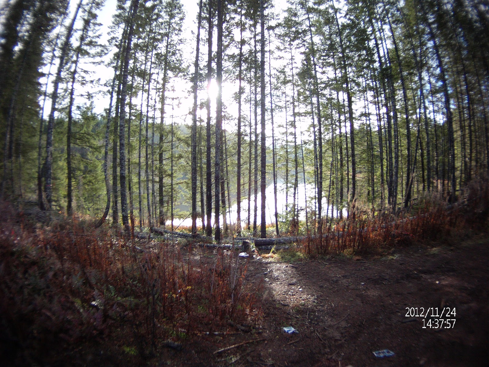
It didn't stop us pretending for twenty minutes or so, though, on our way to the Deadhorse Creek gold mine to be better than we are.  We flew like maniacs for a few miles kicking up dust and clunking our way from Dumount Road (east side of map) and along the hydro trail until we met joined with the 155 main and headed up the key trail to the promised land...   

 Above: the whole trip was about 140 km. Start in the northeast corner and proceed counter clockwise...  
 
After heading up the key trail and crossing into the familiar route down the other side and through the alders, we turned left and headed up towards Panther (Healy Lake).  GE shows a solid line representing a clear trail (quite a large logging road actually) all the way to the Gold Mine from here.  However, as is often the case with GE, it doesn't show washed out bridges and creek beds which you need a trials bike (or a svelte KTM 450) to cross. 
 
 Above: you can see the trail past Healy Lake that we took, thinking that this would take us straight to the Gold Mine.  Alas a creek bed sans bridge was more than a match for our confidence and we turned around.
  
 The bikes at Healy Lake: Fisheries notices remind fishers that the catch limit for trout is "0", with barbless hooks and fly fishing only.  Catch and Release...
 
 
Tracking back from the Healy Lake dummy trail, we headed back on the familiar key trail down towards Nanaimo River Road and joined it just east of Third Lake.  Finally, 2.5 hours or so into the ride, we found an alternative route to the mine at the west end of Second Lake.  Turning up this road, it was my turn to eat dust, and allowed the others to ride on ahead.   
 
After traversing a trail which became fairly green and disused looking, among the trees, we came to a sharp descent, an abandoned camp-site complete with fire pit and obligatory beer can - and parked our bikes.  A short climb down a steep-cliffed riverbank led us down to Deadhorse Creek (blue line above).
 
It was as we parked the bikes that Andy noticed that I had an almost completely flat rear tire...  I had become aware that for the past while, that either the bike was harder to ride than I remembered, or that I was getting tired.  Looking at the tire, it was evident I had been riding this way for a while, and 30-40 minutes back I remembered that I had heard a loud "bang" behind me, which I had erroneously put  down to a bungee cord flying off the bike, as sometimes happens if they are slackened or hit by a branch.  What is sobering, is that at one point we were doing 80 or 90 km along the dirt of River Road after that.
 
Still, I figured I had got it this far, and that if I was careful I could ride out easily.  So on to the mine!  The property itself is privately owned by a European company, and it hasn't been mined for some time.  The details of it's yield can be found here...
 
Above: the mine property with the Straight of Georgia in the background.  The mine entrance itself is at 1923 feet.
 
Seeing the mine for the first time is an amazing sight.  Firstly, it is located behind and beside a waterfall in a deep creek canyon.  You need to use the yellow nylon rope to descend the sides...
 
 
Ryan surveys the prospect (excuse the pun) of lowering himself into the abyss...
 
 Above: The lower canyon; Below: the impressive Deadhorse Creek Mine entrance...dark...deep...bears, gas, gold??
The entrance is amazing and just beckons...


With my tiny micro-light and our pampers, we entered...


 Above: as much light as I could shine in - the shaft splits into two tunnels - the left one heading towards a shaft which goes up vertically 5m through rock.  Impressive.  There are some old timbers holding various parts of this area up.  They do bear load...worrying. But we whispered and walked gingerly around, except for one of my cohorts (who shall remain unnamed) who farted and nearly tripped, stumbling precariously towards the beam.  There was gas down there after all!
Above: Ryan standing outside the entrance, waiting for our Welsh troglodyte to fetch the coffee and the light.
Above: looking vertically up the shaft.  Water drips everywhere in the mine, and the flooring is sedimentary and puddled.  The shafts themselves look sturdy and well constructed.  Surprising.  There was some evidence of wire...explosives?
Above: the obligatory beer can!  It was comforting to know that someone else had been as reckless as us and been in here within the last decade or so...  I didn't check for any dregs... 
 Above: Ryan exiting the mine, taken from half way in, at the junction between two shafts. 
Above: The culprit.  Now for the delusional conspiracy theory...I've never picked up a puncture or a nail before...I'm not sure where I picked up the nail, but if I were guarding a gold mine, I suppose nails could be an effective deterrent...  Rubbish.

I've never fancied changing a tyre is necessary if you can ride the bike out carefully.  Why risk spending hours with substandard tools and potential injuries trying to break the beed, wrestle a recalcintrant tyre off a rim and insert a new inner tube (which you have to carry with all the other tools), only to find that you can still ride the bike and change the tire out of the rain?
The bike was perfectly rideable at reasonable speeds 35-40kmh on the dirt, and 45 - 50 on the black top, although it was slow and arduous.  I can report it is entirely doable though, and even breaks the bead for you: a two in one deal!  I suppose the can of slime I have at home would have been an idea, but perhaps I wouldn't have known I had a puncture and continued to ride on it until...?  The most stressful part of the 40km ride was avoiding damage to my rim by avoiding large rocks etc.  Still, alls well that ends well...  All in all, a great day.  Thanks to Andy for the idea, and Ryan for the truck!
 
It'll be D606 rear for me now.  The TKC 80 rear, while being great on the street and adequate in the dry dirt (not so hot in mud), has lasted a mere two months and a paltry 1500km: it wears like butter.  It was due for replacement anyway...but the nail has hastened it's demise...