Saturday, August 27, 2011

Nanaimo Lakes To Cowichan And Nitnat - Thanks Randy

Randy Neufeld sent me the following GPS track.  I have it in either Google Earth (kml) and GPX for Garmin and other devices.  Randy left comments on Dual Sport BC for me, and imported them into the comments below on the post about attempting to get to Cow Lake from Nanaimo (the aborted one).  The root he says is easy and very straight forward with a huge tarmacked section in the middle!  It starts at 4th lake, winds over a mountain, into the Nitnat Valley and south to Cow Lake.  You can also go north to Port Alberni too.

The picture below is only part of the loop, but we know the rest...


We have to do this before the end of September, perhaps with a camp at Heather, Nixon Creek or Caycuse thrown in on the Saturday night.  The itinerary could be this:

Sat ride to Cow Lake, explore a few spurs on the way.
Sat night: Camp at anyone of the cheap campsites around Cow Lake
Sun: search for the Flora Lake Liberator crash site or go see the Mount Bolduc crash site.  Return home?  Whadya say?

If you want the GPX files or the Google Earth KML file, let me know...

Paul

Monday, August 22, 2011

TT-3D

OK this isn't that other movie (TT-3D which is awesome by the way); this is Tank Trap 3 Disasters the movie.  The first one we'll call SuziQ Abuse (Part 1).  It contains a small technical slip and some camera abuse.  Yes there's more.  The sequel is called "Stunned" on account of the talking.  You have to understand, I was in shock and the Suzi was not best pleased with my piloting.  Calming her down prior to remounting is always the best remedy, or she may well be tempted to buck me off again: it's a little like pacifying the motorcyle goddess...At least that's how I explain my self-babble!

Credits:
Female Lead: SuziQ
Clingon: Me
Lights: SuziQ
Camera: Flip
Terrain: Timber West
Audiable Monologue: Me (If you listen to it backwards, you'll get some great tips on stocks.)

TT3D Part One:


Stunned - The Sequel:

Traversing the Dumount Tank Traps to Freedom...The Movie

This is a two minute video of SuziQ mastering the Dumount connector tank traps into the NorthWest Bay Logging Division Roads.  What's amazing is I didn't realize until the end that I had slogged Suzi through it in second gear!  What a torque monster!  What a clutch!  What an idiot!  

Unfortunately, when we came back, after catching two lovely rainbow trout again, I decided I wanted a turn.  SuziQ graciously allowed me to ride her, but unfortunately I was clumsy and we "fell over" twice.  Those videos will be uploaded at a later day, or perhaps not at all!  It was shot with a Flip Mino HD (an Iris win).  The Fip was damaged in the falls, but still works! 


Sunday, August 21, 2011

Domount Road to Youbou...Can It Be Done?

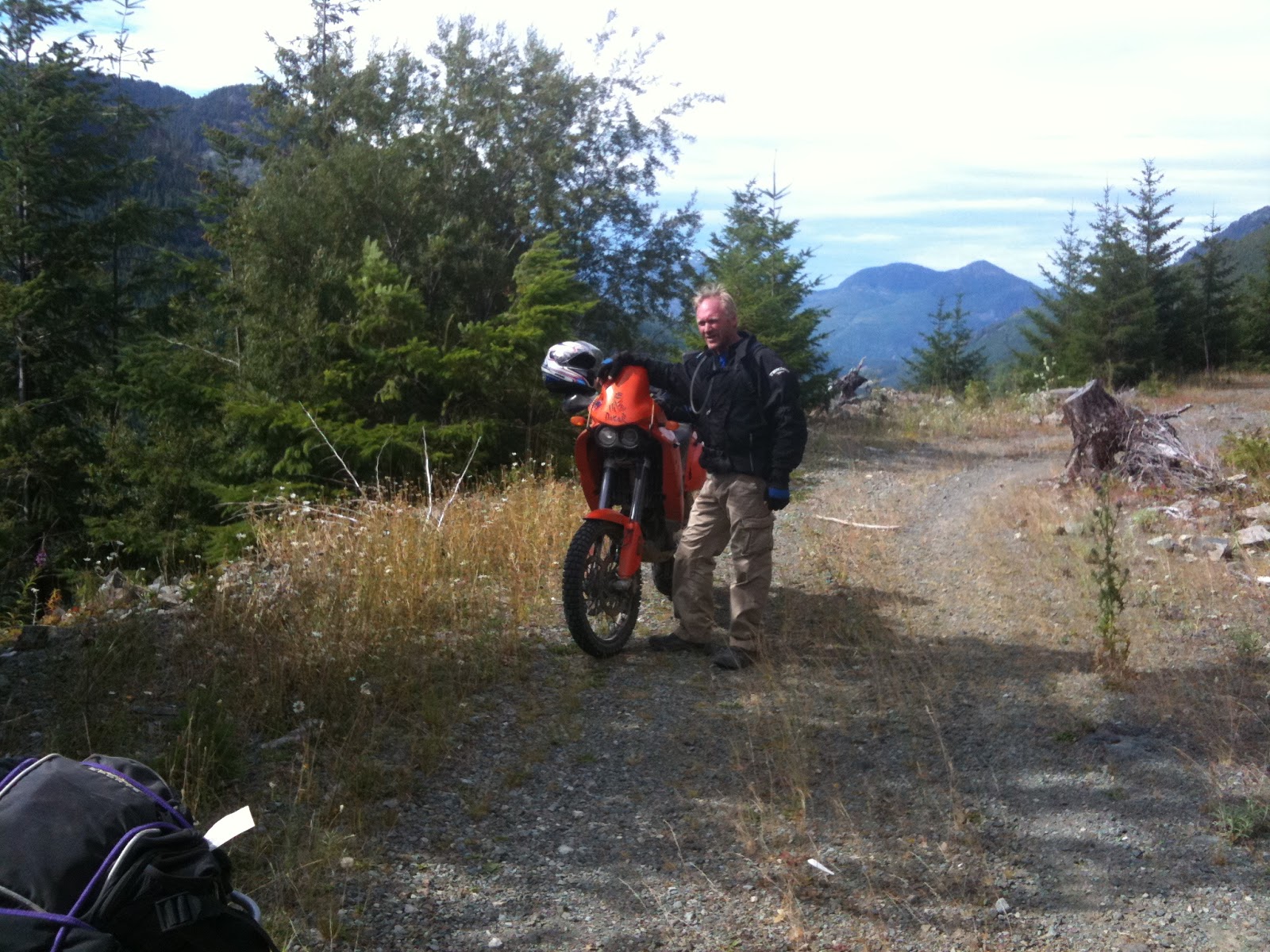
Well today Ryan and I tried to get from Dumount Road to Youbou, or Cowichan Lake.  Dumount to Nanaimo Lakes road was straightforward down past Boomerang, left at Cottle, past Blackjack right to cross the power lines and out to Nanaimo Lakes road just east of 1st lake.  So far so good.

Just before turning left after 2nd lake and crossing a river

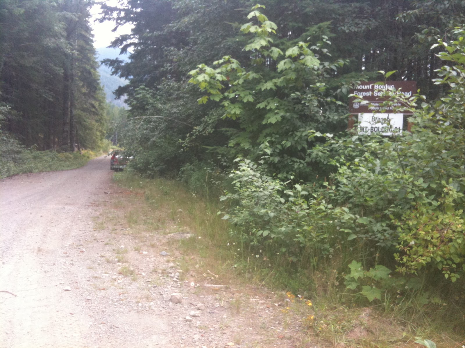
Then we followed 2nd lake's north shore and peeled left at a bridge to follow the Nanaimo River on it's south side.  Finally the road turned south onto what the backroad map book calls Branch K.  Branch K leads south past Butler Peak on your left (east) and past Mewhorst Lake (McWilliams or Gillespie depending on your map source!) on your right (west).  It's then, according to my GPS Topomaps and the Backroad Mapbook, supposed to turn south west (right) into East Shore Main or Cottonwood Main if you go left (south east).  Both still head roughly south, but East Shaw comes out further west on Cowichan Lake, while Cottonwood comes out at Youbou. 

Well that was the plan.  We proceeded down Branch K for about ten km.  The road was great at first, but got smaller and smaller.  Ryan pulled over, having his doubts that this was a main.  We plugged on until finally we got to this...

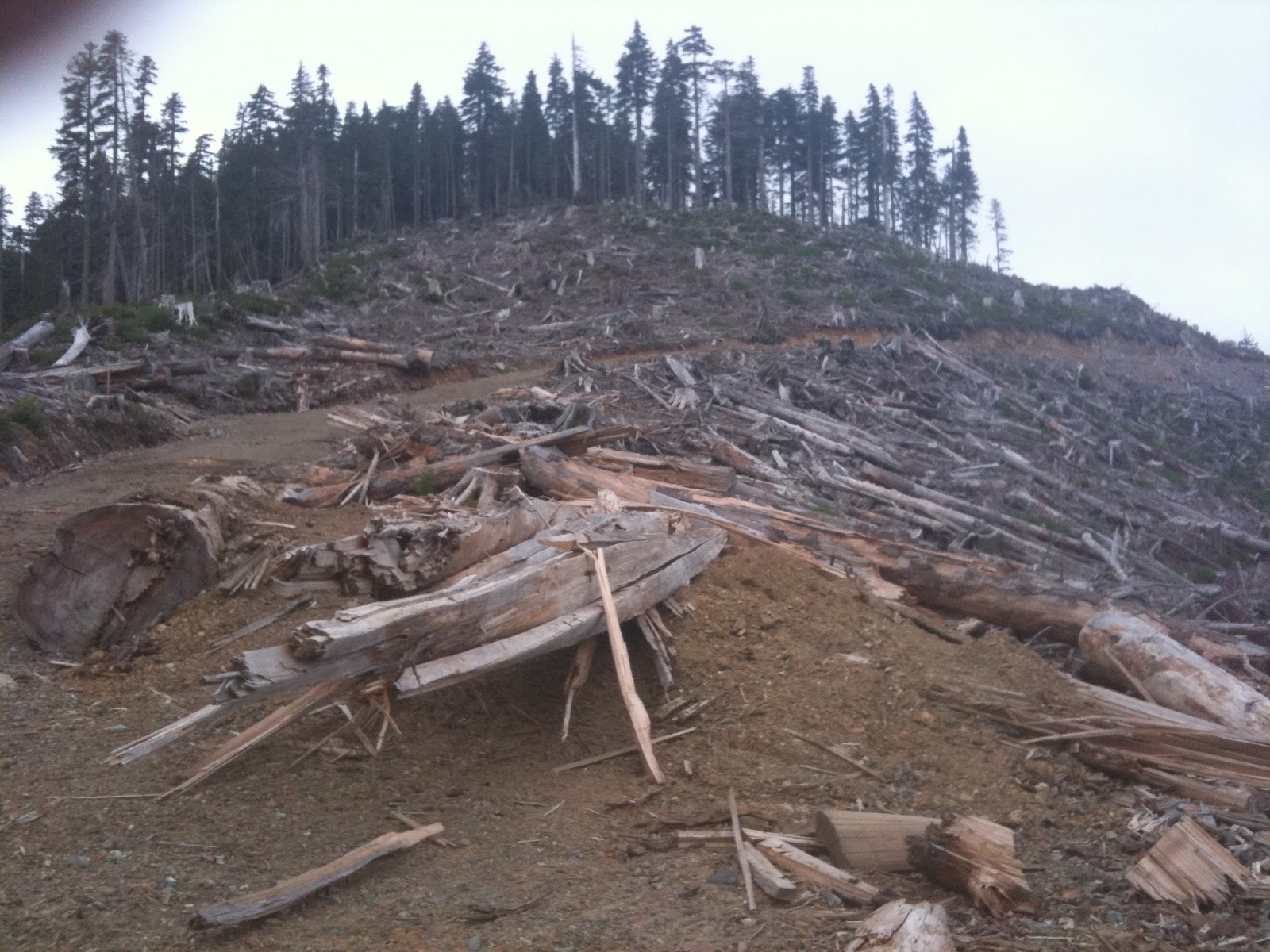
In the distance: the bridge deck has been chopped by the logging companies.  This seems to be the boundary between Timberlands and TimberWest...And they don't want you to cross...

There is a sneak around for quads, but it looked like it would be hard work.  The road on the other side looked excellent...better than what we had been on.  We even saw truck with a canoe on top pass us in the opposite direction earlier. How did they get around?  So we decided to back track to where we had seen a fairly significant looking logging road branch off to the left.  We'd give that a try.  Perhaps that was the way round?


The view was nice...but the road got steeper...and started to disintegrate into a skidder track...These pics make it look great, and it was here...but later on it was a different story...


Luckily for me, Ryan didn't have his camera out, as I slowed down too much on a steep bouldery grade and gracelessly fell over.  Bike and rider were ok, but it was a reminder that going out alone and tackling "roads" like this particular skidder track is not a good idea.

So again we backtracked, but not all the way back.  We found another left of the first left detour...and tried it.  I decided to have a swig of my water, while Ryan was going to reconnoiter it.  If he didn't return, then I'd know it was a good bet and I'd chase him up.  After 7 minutes and no Ryan, I decided it was a good bet and went up.  And up.  And up.  And up.  Bear poo.  Ryan?  No.  Had I missed him.  Was this the right road?  Had he turned off another spur?  Had there been another spur.  And up.  Getting tricky now.  Surely he can't be any further up here, the surface has gone skidder again....Bingo.  There he is.

We continued on.  Finally, after a lot of exploration we came to a fork which had a rock spray painted with blue writing: "HELL ->"

You know what we did don't you?  Yep, we followed it.  And, well, yep, it was Hell.  Washouts, bizarre bike snapping holes in the road, more washouts, land slides and finally it petered out into an alder choked goat path.


After passing the landslide, we decided this wasn't the route to Youbou!

We backtracked back down the mountain, slowly in my case, and fairly uneventfully, and decided, given the late hour, to head back to my house for salmon, beer, gin and crumble. 

Yes we were skunked, but it does mean we have to try again!  And that's good, right? 

Looking at Google Earth, I just can't see another logical path that seems to stand out. Of course, I've heard from too many folks that they often travel from Nanaimo to Youbou via logging roads, so there must be a way... More research I guess.

Personally, I'm thinking that bridge-out-sneak-around is the way to go...Whatddya think, Ryan? :-)

Here's a map of a small portion of the journey from Google Earth with a few waypoints on it...

Paul.

Monday, August 15, 2011

Treasure Hunting for a Crashed Lockheed Ventura on Mt. Bolduc

On August 13th, 2011, I decided to set off and look for a crashed Lockeed Ventura from 1944.  It was a crazy idea being as it was so late in the day and I'm 80 or so km away from the start of the logging road which eventually takes you to the site...albeit up a very steep trail.  But the result was challenging, great fun, and very moving at the same time.  Filling up in Nanaimo, I headed on.

During World War II on April 25, 1944 a Lockheed Ventura Coastal Patrol Plane with a crew of 6 became disoriented on a flight from Patricia Bay to Tofino. The plane crashed on Mt. Bolduc with no survivors. A cairn located nearby marks the grave and records the names of the crew, who were all found in and around the smouldering wreckage, albeit dead from the trauma of the impact.  You can read more details about the crash and the attempts by the locals to find the "survivors" from the original story taken from the Cowichan Leader, dated May 1, 1944.

Getting to Gordon River and taking the left soon gets you to this sign where you take a right fork.

Above: This is the trail you will follow nearly all the way to the top of Mt. Bolduc.  The views and terrain are stunning along the way.  Because of some of the grades, I was really happy with the grunt of Suzi Q...

Above: You're heading up that valley.  The road is fairly level here, with nice crush and easy riding.  That will change...but not drastically enough to deter this novice...

You can see the valley behind that you have meandered up.  The road surface is still great; the grades not too bad either.  But don't get a puncture, there is no cell reception...at all.

6km up, the Grade is getting gradually steeper, and the cribbing is there to stop the boulders.  The road itself is cribbed as the drop off is quite steep.
The grade is starting to steepen.  Just ahead the surface deteriorates and there is a hairpin turn with a much steeper grade.  This is where I'm glad I've got a torque-monster and nobblies...You can go slow enough not to slide out of the turn, while maintaining enought traction to defy gravity...  Keep yer feet on the pegs and your bum in the air.  Lean forward!
When you get to the end of that road, know that you have gone too far!  You're at the summit.  Walk up and get a fabulous panoramic view - you're at well over 3000 feet.  There's likely snow on the north slopes of the hills around you - in August...
As you can see it was getting late...But I hadn't found the wreck yet...Heading down, I was cognizent that I was alone, there were bears everywhere and I had no cell reception.  Quit and go home?  No!
The cross which marks the beginning of the crash site, is just in from the road, by a tree with a faded blue and a faded orange ribbon tied around it.  They're hard to spot if, like me, you're concentrating on traversing the freshly blasted boulder crush they've used to construct the road in this section.  The loggers have refused, out of respect, to log this area.  What you are seeing is original growth forest.  This makes the crash site - 30 seconds walk from here - a reverent and moving place, set in, if you like, a natural cathedral-like atmospheric situation.  The cloud-mist adds to the moving atmosphere of the hallowed ground.  And it is hallowed ground (the sign below makes that plain, apologies for the crappy resolution):


The Ventura is scattered in roughly a straight line from the top of Mt. Bolduc through to just near the road.  It is a testament to the respect shown by visitors that nothing has been defaced or disturbed (unlike the Tofino Canso Crash site...).  I'm not going to blather on anymore, I'll just leave you with the photos, and say it was an amazing day.
Look for the ribbons where the crush ends on the left...

Sunday, August 14, 2011

Learning to mount and ride SuziQ...

Starting in early Spring 2011, my plan was to explore the many island back-roads and off-the-beaten path attractions that Vancouver Island has to offer.  A spot of fishing, camping, geocaching, historical sites, beauty spots, aircraft wreck sites, and dirt biking would make this even more attractive.  Having been a street rider since I was 16, it would also be completely foreign to me and a new horizons to discover.  Also, my friend, Ryan is fully culpable for hooking me on his little Yam TTR125...He knew exactly what he was doing.  Resistance was futile.  For the first year, I decided I would start on local forestry service roads, and as confidence grew, I would expand out from there...

But it was daunting.  I'm not used to hopping curbs or having tires break loose under me on the street, let alone on trails like this.  Trails like this are simply not in my repertoire...


  Doesn't look too bad?  Now add H2O...


And that is why you need nobblies...Small hint: don't stop upslope or in a puddle...Don't ask me how I learned that.

Then there's riding on marbles.  When the logging complanies grade the forestry service roads, they tend to use round pebbles which are perfectly designed to kill 2 wheel off-road novices like me.  Riding while sitting is not an option if you want to get out of first gear and stay upright.  Stand on your pegs, lower the bike's centre of gravity (thanks, Ryan)...Stand on the balls of your toes, lean forward, grip the tank with your knees, rest a finger on the clutch, front brake and gently caress the bars.  Allow the bike to work and move with the wheel's gyroscopic motion correcting the tendency to fall by automagically steering into it.  It works!  Pressure on the pegs helps to steer the bike, with more pressure on the outside peg when leaning the bike into a corner.  The bike stays up, you feel "like you're on a magic carpet ride" (Ryan again), and you can make excellent time, which in my case is 60-70kmh rather than 20...Confidence grows quickly, and you find yourself asking if this can be the same person, bike, and road that was so uncomfortable and potentially neck snapping as before...


Why do this?  So you can visit and see things like these...


Yes, I was the only one on the lake.  The cutthroat trout were jumping everywhere, and, yes, they tasted great.  Something else: this lake is fifteen to twenty minutes from my residence situatated, as it is, in the middle of a very residential community within a city.  But only if you have a dirt bike.  No dirt bike: no fish.  And that's why every cast is a bite...Skunked?  Who cares, you get to ride the trails back!

Who is SuziQ?

Suzi Q?  She is a Suzuki DR650.  The DR650 is a venerable design.  I picked the model for several reasons:
  • Proven reliable design and bulletproof reputation
  • Big bang for buck = cheap!
  • Simple air and oil cooling
  • Torque monster
  • Lighter than KLR and better off road
  • Moderately tolerable on highway
  • Lighter than most other dual sports of similar cc
  • Handsome (OK that's an exaggeration...but don't tell her I said that!)
There are a few areas that I needed to improve in order to make it a safe and more capable trail rider
  • Skid plate with side protectors from Procycle to fend off boulders, rocks and roots.  You really DON'T want a cracked crank casing...
  • Set of DOT knobblies (Continental TKC 80's) that are good excellent on the road too
  • 20 L Long range clear plastic fuel tank (IRC) as the OEM tank capacity is too small (12L) for serious off road excursions and the bike has no fuel gauge.  Now the fuel gauge is unbelievably accurate and reliable!
  • Rear Rack for carrying stuff...
  • 14 tooth countersprocket to replace the 15 tooth for higher gearing off road
Wish List
  • TM-40 pumper carb so I can put the 15 tooth countersprocket back on for lower rpm highway cruising...
  • Two more rims to mount street tires when commuting to save wear on knobblies
  •  Nothing else.  The bike is the best compromise for on/off road.  KLR's eat your heart out (if you have one...soulless buggers!)