I had every intention of going fishing at Rhododendron Lake today, but had a change of plan after heading half the way there and meeting ice and heavy frost at about 2000 feet. So I decided to check out Kidney and then on to the Sundew Main with the intention of seeing if the gate was passable.
The ride was great, and there quite a few bikes and quads out; in fact, it was busier than I remember it all summer -almost as if it was a last fling for many people given that the weather was great and the Grey Cup is on tomorrow.
The story is via photo and vid...
Above you can see my attempt to cross from Sundew Main onto Seablush Drive, but the gate is absolutely unpassable. So it's east on the hydro line trail to find a way out... The Logging Co have done their best at the Sundew Gate, and it's working. Not even a quad has tried - once - in months. And no wonder...
...Even if you could traverse the traps, they've got rocks and cement barriers installed to make sure that nothing can pass.
Either of the two forks on the left as you run east along the easy power line trail will work: Wild Rose Blvd and Seablush have connectors suitable for bikes to the road. No quads though: you boys will be stuck - the passes are too narrow.
I explored further along the hydro trail and hit two very steep hills after riding through a creek which was a neat experience. The D606 surprised the heck out of me by getting me up both of the rocky-boulder strewn and quad-chewed single-track paths easily. "Thank God I don't have to come down them!" was my thought at the time. That turned out to be premature. Because after exploring a trail that went north into some woods and ran behind some properties, I re-emerged on the hydro trail and continued East. However, as you can see, my trail stops at the edge of the photo. An adjacent land owner had seen fit to extend his property by fencing right across the hydro lines so his horses can "wander"... If desperate, you could get through, but not without vandalism, and two wrongs don't make a right, so I turned around knowing that those steep hills beconed...
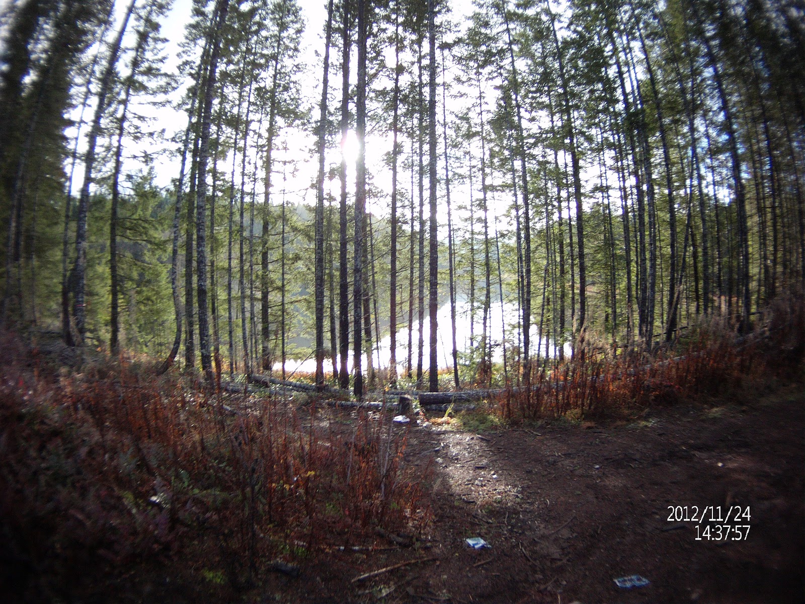
This is what the Wild Rose Blvd entrance to the hydro lines looks like. My camera is centred on the route. Just continue towards the maple; keep it to the left if going towards the hydro trail, traverse a short walking trail and - voila - you're there. Note the sign. Walking, bicycling and horse riding only - By order of Timberlands.
This is an old car wreck in the woodsy section of the trail above to the north of the hydro-lines. It was surrounded by a couple of racing bicycles that had been stripped of their parts...Mmmm: stolen goods? Properties back onto this trail from the north, but there is no obvious way out to the road, and I didn't fancy meeting a toothless local with a bevvy of dead squirrels and a shotgun. The track peters out, and so you have to double back, take a left, ride up some gnarly grades with roots (a walking trail really) and, thankfully - because at this point I had no idea where I was going! - back to the hydro lines.
This is the section of the hydro lines where you cannot get through because a local 'billy has decided he's claiming, complete with horses roaming around inside... So it's turn around. Pity, because I could see black top half a click on...
While the wide angle camera makes this look relatively flat, it is just about as steep as it's possible to get a bike down. It is extremely steep and I don't recommend doing this (again - in my case). There's really no need to, as the trail behind doesn't lead anywhere except to the hillbilly's land claim...
Here are some shots and vids from the rest of the ride:
Above: Kidney Lake
A kind gent has left a fuschia picnic chair to fish from. He used worms...
Kidney looking serene, but lifeless. Nary a rise did I see.
This is a vid which shows the creek crossing, up a steep grade (which again is very flattened out by the fisheye perspective of the lens (- I warned you!). The left turn is the turn into the woods which runs down towards Nanoose Bay and parallels some properties. At the end is the car wreck.
I found a route that Ross Collicutt has taken via car and snowshoe from 2nd Lake up to the Summit. Here are some route maps which take you right past the Deadhorse Creek mine...
Here is an interesting article. I'm not sure what it means, if anything, for us on Vancouver Island, but it's perhaps a chink of light at the end of the tunnel. There are few interesting statements in it; for instance, Quads/ATV's must be insured by Nov 2012 to go offroad... Anyway here is the article. Be sure to read the comments on the web page after the article:
Governmental policy changes means more room to ride
Robert Barron, Daily News
Published: Monday, July 02, 2012
Members of the Nanaimo-based Mid-Island ATV Club are pleased with governmental policy changes that will open up more trails and back roads in the province.
Kye Francoeur, one of the approximately 300 members of the club, said anything that provides more access to the thousands of kilometres of forest and other privately owned roads in the region to responsible and recreational users is welcome to local ATV enthusiasts.
The province announced recently that amendments to the Occupiers Liability Act, to help prevent resource road closures and reduce the possibility of injury-related lawsuits, have come into effect as the general public heads into the back country to enjoy B.C.'s wilderness this summer.
Nanaimo-area all-terrain vehicle riders are pleased with governmental policy changes that will open up more trails and back roads in the province.
B.C. has an estimated 450,000 kilometres of resource roads that provide commercial and recreational links to vast expanses of the province's back country. Currently, roads that do not access year-round communities are sometimes closed to the public after an industrial user no longer needs the road.
The amendments will help keep more back-country roads open by establishing that people using resource roads of their own accord do so substantially at their own risk.
In addition to lowering the duty of care owed by the Crown and those that maintain the roads, the revised legislation shifts the onus for personal injury insurance coverage to third-party users and brings the government's resource-road policy into line with policies covering rural agricultural land and marked recreational trails in other jurisdictions.
Francoeur said club members are already required to have at least liability insurance to deal with any incidents with other vehicles and people that are encountered on the back roads and trails.
He said that means more trails will be instantly available for their use.
"Problems have come up in the past when people on machines that aren't registered and insured have had accidents with logging trucks and other vehicles while on these roads," Francoeur said.
"Our members have always made it a point to be respectful of the rules and it's good to hear that responsible riders will now have access to these trails."
Minister of Forests, Lands and Natural Resource Operations Steve Thomson said the policy changes are an important first step to simplifying the regulations covering B.C.'s vast network of resource roads.
"Reducing the possibility of injury-related lawsuits will encourage road maintainers to keep roads open and preserve access to B.C.'s wilderness areas," he said.